
AUSTIN, Texas — Much of the region has dried out, with our risk for severe weather becoming basically zero. But as the front continues to jog east this evening, it's possible it could kick up a few more isolated storms, which could, reach severe limits.
The majority of the KVUE viewing area stays in a "marginal' level 1 out of 5 risk for severe weather this evening. All in all, we won't be completely out of the woods until that boundary moves through late tonight.
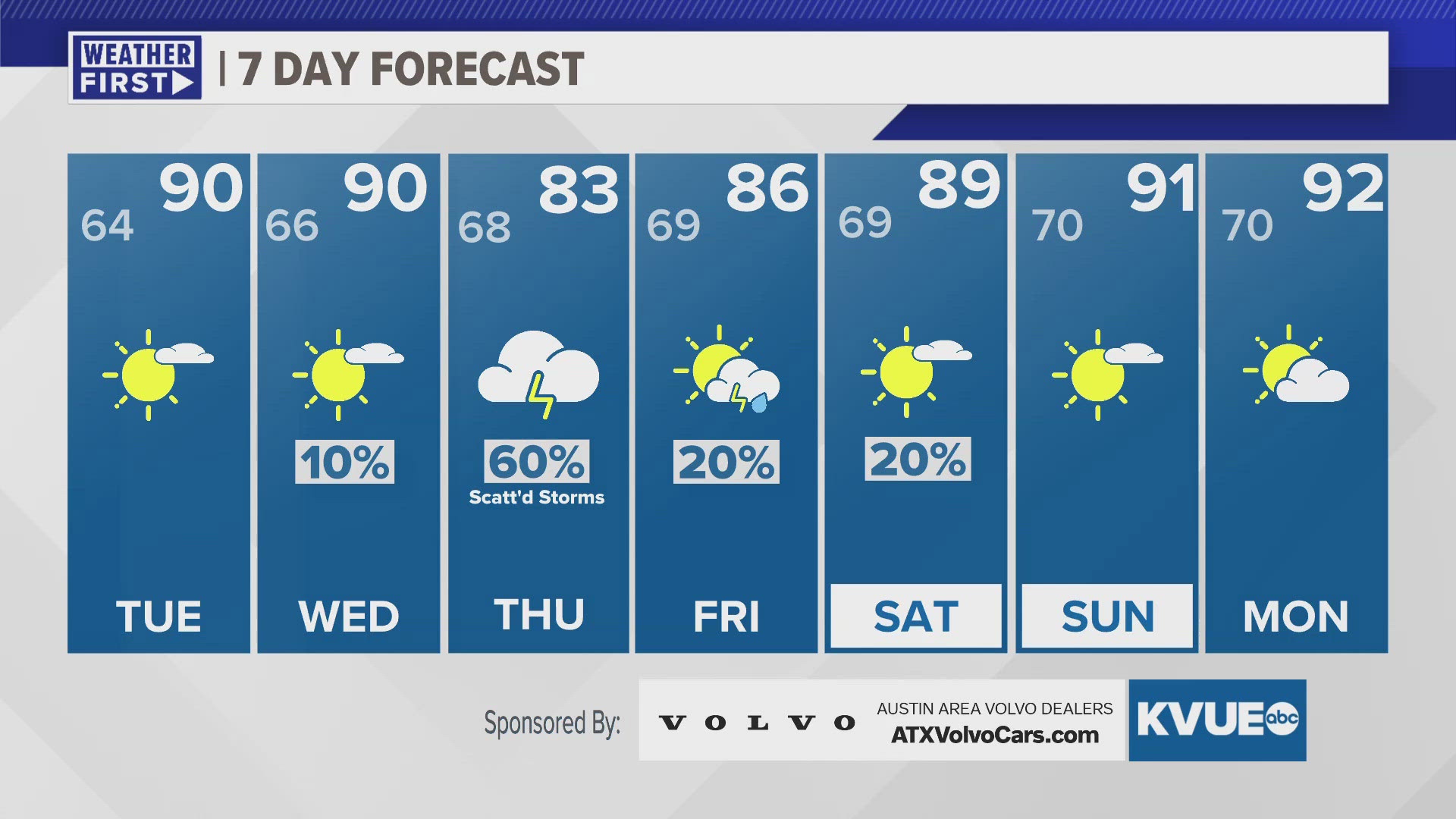
The weather gets quiet for a few days after this. Both Tuesday and Wednesday, temperatures will rise into the upper 80s and lower 90s in the afternoon, with the sun expected to make a reappearance too.
On Thursday weather returns, with a 60% chance for scattered showers and storms. It's a bit too far out to talk about severe weather details, but if you have outdoor plans, keep an eye on the forecast. Otherwise, it looks like this weekend trends drier and warmer too, and our rains this week have helped lake levels trend upwards.
MONDAY:
Mostly cloudy. Scattered showers and storms possible midday through early evening. Some storms could be strong. Southeast wind at 5 to 10 mph, with gusts around 20 mph.
HIGH: 84
MONDAY NIGHT:
Mostly cloudy and mild. North wind at 5 to 10 mph.
LOW: 65
SEVEN-DAY FORECAST:


Check out the live radar for what you can expect the rest of the day and into the workweek.